gontsainIn Ukrainian60 мап про Україну в межах #30DayMapChallengeЦього року, як і 2019 року, я брав участь у найкращому картографічному виклику #30DayMapChallenge, де учасники з усього світу створювали…2 min read·Dec 12, 2020----
gontsaMy #30DayMapChallenge, 2020A short story about participating in a challenge for cartographers in 20202 min read·Dec 2, 2020----
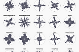
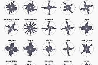
gontsainMaparnyaПорівняння мереж вулиць українських містМапарня проаналізувала мережі вулиць обласних центрів України3 min read·Jul 17, 2018--7--7
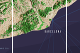
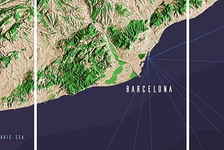
gontsaBarcelona, SpainFor this project, I chose the coastal part of Catalonia, Spain. Without urban areas, only relief, forests and part of the infrastructure…1 min read·Sep 2, 2017----
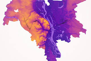
gontsaKyiv — digital terrain modelDigital elevation model (DEM) accurately describes the nature of the relief of the city — the difference between its banks (powerful right…1 min read·May 26, 2017----
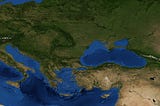
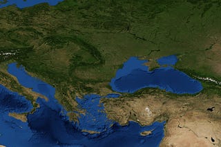
gontsaSeasons changeUsing images from visibleearth.nasa.gov and small bash script created a short video from the monthly images (2004) to show how the seasons…1 min read·May 25, 2017----